Catalogue of glider research projects and initiatives

Catalogue of glider research projects and initiatives

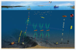
One could only witness the growing glider activity throughout the world since the pioneer deployments in the late 1990s. Worth mentioning are an impressive glider fleet demonstration which was carried out in 2003 in the framework of the experiment Autonomous Ocean Sampling Network (AOSN) II and several endurance lines that started to be maintained on both the West and East coasts of the USA. This activity has been growing in the USA since then, and in particular recently, in the framework of the Integrated Ocean Observing System (IOOS). In 2004, in parallel to the development of the glider activity in the USA, the first European glider experiments were carried out in the framework of the European project MFSTEP of the Fifth Framework Programme (FP5). Later, the European FP6 project MERSEA in 2006-2009, and later, several FP7 projects, as well as, several national past and on-going projects, (have) support(ed) glider operations in European and foreign waters. In the mean time, Australia has developed the ANFOG infrastructure to operate gliders in a sustained way.

Among all the glider projects, there were 2 EU projects in particular, that were strongly related to the EGO community development, trying to develop a holistic approach for gliders to be integrated in the global ocean observing system:

There are many process studies and observational programs involving gliders and or exploring the synergies with the other observing platforms. The list of links below is certainly not exhaustive but already somewhat demonstrates the enthusiasm of oceanographers for this glider platform which is able to carry out observations in a original and innovative way.

AlterEco

An Alternative Framework to Assess Marine Ecosystem Functioning in Shelf Seas

Arctic Prize

Arctic Productivity in the Seasonal Ice Zone

AWA

Ecosystem Approach to the management of fisheries and the marine environment in West African waters

BB-Trans

3D transport Bay of Biscay

BoBBLE

Bay of Bengal Boundary Layer Experiment

Bothnian Sea water exchange

Bothnian Sea water exchange

Bremer

EP2 - Surveying marine life in the canyons off Bremer Bay

CANALES

Canales Endurance Line

CINEL

Consiglio Nazionale delle Ricerche

COCONET

Towards COast to COast NETworks of marine protected areas

CONVEX

Marine Autonomus and Robotic Systems

COSYNA

Woods Hole Oceanographic Institution

CYCOFOS

Cyprus Coastal Ocean Forecasting and Observing System

DOCONUG

Deep ocean convection: observations from an adaptive network of underwater gliders

EEL

Extended Ellett Line

ESTOC

Australian National Facility for Ocean Gliders

EU H2020 AtlantOS

Optimising and Enhancing the Integrated Atlantic Ocean Observing Systems

EU H2020 BRIDGES

Bringing together Research and Industry for the Development of Glider Environmental Services

EU H2020 ENVRI+

Bringing together Environmental and Earth System Research infrastructures

EUREC4A

EUREC4A

FASTNEt

Fluxes Across Sloping Topography of the North East Atlantic

GAB

Great Australian Bay

GINA

Gliders in the Agulhas

iFADO

Innovation in the Framework of the Atlantic Deep Ocean

IntarOS

Integrated Arctic Observation System

JERICO TNA

JERICO Transnational Access

KUGON

Kyungpook National University

LIVINGSTONE

Etude des échanges côte-large et de leur variabilité par l'intermédiaire d'un réseau de planeurs sous-marins (gliders) : application au Golfe du Lion

Lofoten Bassin

Alseamar-ALCEN

LOGMEC

Long-Term Glider Mission for Environmental Characterization

MASSMO

Marine Autonomous Systems in Support of Marine Observations

MATUGLI

Mesures Autonomes de la Turbidité côtière à l\'aide de GLIders

MEDREP

British Atlantic Survey

MERSEA

Marine Environment and security for the European Area

MFSTEP

Mediterranean Forecasting System Towards Environmental Predictions

MISTRALS

Mediterranean Integrated STudies at Regional And Local Scales

MOOSE

Mediterranean Ocean Observing System for the Environment

MOSES II

Modular Observation Solutions for Earth Systems

NREP

Nordic Recognized Environmental Picture

OCS_S Rockall Trough

Ocean Climate Survey_S Rockall Trough

ODYSSEA

ODYSSEA H2020 Glider program

OSMOSIS

Ocean Surface Mixing, Ocean Sub-mesoscale Interaction Study

OSNAP

Overturning in the Subpolar North Atlantic Programm

PERSEUS

Policy-oriented marine Environmental Research for the Southern European Seas

PLOCAN GliderSchool

PLOCAN GliderSchool

PREFACE

Enhancing prediction of tropical Atlantic climate and its impacts

Projeto Azul

Projeto Azul

ProVoLo

Bermuda Institute of Ocean Sciences (BIOS)

RidgeMix

RidgeMix

RITMARE

Oregon State University, College of Earth, Ocean, and Atmospheric Sciences

SACUS

Southwest African Coastal Upwelling System and Benguela Ninos

SPICE

Southwest Pacific Ocean and Climate Circulation Experiment

SSB

Shelf Sea Biogeochemistry

Svinoy

Monitoring the Atlantic inflow through Svinøy Section

TasEastCoast

Tasmania East Coast

TwoRocks

UK-IMON

Integrated Marine Observing Network

VOCALS

VAMOS Ocean-Cloud-Atmosphere-Land Study Regional Experiment

LIVINGSTONE Icon

LIVINGSTONE

Les objectifs de LIVINSTONE sont d\\\'étudier les échanges entre les eaux côtières et celle du large à travers le talus continental à l\\\'aide d\\\'un réseau de planeurs sous-marins (gliders) et de chercher à dimensionner au mieux les contraintes d\\\'utilisation de cette nouvelle plateforme instrumentale autonome de mesure in-situ.

MOOSE Icon

MOOSE

MOOSE combines eulerian observatories and autonomous mobile platforms to enlarge and enhance the Mediterranean observation: * to observe the long-term evolution of the NW Mediterranean Sea in the context of the climate change and anthropogenic pressures * to detect and identify long-term environmental anomalies * to build efficient indicators of the health of the NW Mediterranean basin

PERSEUS Icon

PERSEUS

PERSEUS is a research project that assesses the dual impact of human activity and natural pressures on the Mediterranean and Black Seas. PERSEUS merges natural and socio-economic sciences to predict the long-term effects of these pressures on marine ecosystems. The project aims to design an effective and innovative research governance framework, which will provide the basis for policymakers to turn back the tide on marine life degradation.

JERICO TNA Icon

JERICO TNA

The primary objective of the TNA activity (WP7) is to provide coordinated ‘free of charge’ trans-national access to researchers or research teams from academy and industry to original coastal infrastructures operated by the JERICO NEXT consortium. This access opportunity is expected to help building long-term collaborations between users and JERICO-NEXT partners, and to promote innovation and transfer of know-how in the coastal marine sector.

MISTRALS Icon

MISTRALS

“A decade to observe and understand, predict the habitability over a century” MISTRALS (Mediterranean Integrated STudies at Regional And Local Scales) is a decennial program for systematic observations and research dedicated to the understanding of the Mediterranean Basin environmental process under the planet global change. It aims to coordinate, across the Mediterranean Basin, interdisciplinary research on atmosphere, hydrosphere, lithosphere and paleo-climate, including environmental ecology and social sciences. The objective is to achieve a better understanding of the mechanisms shaping and influencing landscape, environment and human impact of this eco-region. Thus, its aim is to anticipate the behaviour of this system over a century, from an interdisciplinary analysis conducted over the 2010-2020 decade. The ultimate goal of this program is to predict the evolution of habitable conditions in this large ecosystem, to meet the public policies concerning resources and environment, to anticipate evolution of the societies and to propose policies and adaptative measures that would optimize them.

IntarOS Icon

IntarOS

Stein Sandven (stein.sandven@nersc.no) is the project PI. Maire Noelle Houssais and Christophe Herbault are in charge of the glider deployments in the project. The overall objective is to build an efficient integrated Arctic Observation System (iAOS) by extending, improving and unifying existing systems in the different regions of the Arctic.

CONVEX Icon

CONVEX

National Oceanography Centre Joseph Proudman Building 6 Brownlow Street Liverpool L3 5DA United Kingdom

EEL Icon

EEL

Flow in the eastern subpolar North Atlantic is an important component of the global thermohaline circulation and thus has an important role in regulating climate. Around 90 % of the upper ocean inflow to the Nordic Seas passes between Iceland and Scotland, whilst ~50 % of the cold dense outflow returns through the same area. The Extended Ellett Line (EEL) is a standard hydrographic section between Scotland and Iceland designed to monitor these critical flows. The Extended Ellett Line was started in 1975 by Dave Ellett, a physical oceanographer at SAMS. Until 1996 effort focused on the Rockall Trough portion of the section often with several occupations each year. Since 1996 the section has been extended to Iceland with regular measurement of nutrients and oxygen in addition to temperature and salinity. Although the predominant aim of the Extended Ellett Line is to monitor the physical and chemical oceanography of the region, the annual cruises provide a platform for additional science as well as training for the next generation of marine scientists and engineers. Whilst research cruises enable a wide range of parameters to be measured, they are naturally biased towards the summer months when the weather in the region tends to be better. To address this, SAMS has been using an autonomous Seaglider to sample along the Extended Ellett Line transect during the under-sampled autumn, winter and spring months. This provides valuable data to supplement that obtained from the annual cruises.

AWA Icon

AWA

Ecosystem Approach to the management of fisheries and the marine environment in West African waters. (AWA) is a cooperative project with partners from Senegal, France, Germany, Cape Verde, and other West African countries (see webpage: AWA homepage) that started in January 2013. PI - Patrice Brehmer IRD, UMR Lemar, BP 70, Campus Ifremer, 29280 Plouzané

CINEL Icon

CINEL

Arsenale - Tesa 104, Castello 2737/F, 30122 Venezia, Italy

OSNAP Icon

OSNAP

OSNAP is an international program designed to provide a continuous record of the full-water column, trans-basin fluxes of heat, mass and freshwater in the subpolar North Atlantic.

BoBBLE Icon

BoBBLE

We aim to better understand how heat and salt is transported from the Arabian Sea, how this water mixes with the freshwater from the river input in the northern Bay of Bengal, and how these processes influence the monsoon.

KUGON Icon

KUGON

Kyungpook National University, Daehak-Ro 80, Buk-Gu, Daegu-Si, South Korea

FASTNEt Icon

FASTNEt

The Fluxes Across Sloping Topography of the North East Atlantic (FASTNEt) consortium aims to improve current understanding of exchange processes taking place at ocean–shelf boundaries. A combination of novel observational strategies and modelling techniques will focus on the shelf edge, west of the UK, as part of a four year scientific study

MEDREP Icon

MEDREP

British Antarctic Survey High Cross Madingley Road CAMBRIDGE CB3 0ET

ESTOC Icon

ESTOC

Ocean Gliders Facility, Integrated Marine Observing System (IMOS), 35 Stirling Highway, 6009, Crawley, Western Australia, Australia

ODYSSEA Icon

ODYSSEA

ODYSSEA will develop, operate and demonstrate an interoperable and cost-effective platform that fully integrates networks of observing and forecasting systems across the Mediterranean basin, addressing both the open sea and the coastal zone.

MASSMO Icon

MASSMO

The mission will comprise a range of oceanographic data collection, but with a particular focus on passive acoustic monitoring of marine mammals and oceanographic features. MASSMO4 will be co-ordinated by the National Oceanography Centre (NOC), with research partners including University of East Anglia (UEA), Scottish Association for Marine Science (SAMS) and Plymouth Marine Laboratory (PML). The mission will be sponsored by Defence Science and Technology Laboratory (Dstl) and will involve close co-operation with the NATO STO Centre for Maritime Research and Experimentation (CMRE) and UK Royal Navy, and will be supported by several additional commercial, government and research partners. David Smeed and Justin Buck are the MASSMO contact point for glider observation.

CYCOFOS Icon

CYCOFOS

The Cyprus Coastal Ocean Forecasting and Observing System (CYCOFOS) is a sub-regional forecasting and observing system in the Eastern Mediterranean Levantine Basin, which covers the coastal and open sea areas of Cyprus, Cilician and Lattakian basins and the Eastern Levantine Base.

COSYNA Icon

COSYNA

Woods Hole Oceanographic Institution is the world's largest private, non-profit oceanographic research institution and a global leader in the study and exploration of the ocean.

EUREC4A Icon

EUREC4A

EUREC4A aims at advancing understanding of the interplay between clouds, convection and circulation and their role in climate change: How resilient or sensitive is the shallow cumulus cloud amount to variations in the strength of convective mixing, surface turbulence and large-scale circulations? How do the radiative effects of water vapor and clouds influence shallow circulations and convection? To what extent do mesoscale patterns of convective organization condition the response of clouds to perturbations? And what are the implications of all of the above for how clouds respond to warming?

RITMARE Icon

RITMARE

104 CEOAS Administration Building, 97331-5503, Corvallis, Oregon, United States

CANALES Icon

CANALES

repeated section accross the Balearic current between Balearic Island and Iberic peninsula.

Svinoy Icon

Svinoy

The Norwegian Atlantic Current (NwAC) through the Norwegian Sea is a poleward extension of the Gulf Stream and serves as a conduit of warm and saline water from the North Atlantic to the Arctic Ocean. A change of this transport may cause dramatic climatic-related changes, such as reduction of the Arctic sea ice cover and ecological disruptions. Quantifying and understanding the variability of the transport within and between these regions is thus important for our understanding of the climate system, both in Northern Europe and the Arctic. The Svinøy section (SS) cuts through the entire Atlantic inflow just to the north of the Scotland-Iceland Ridge and is as such a suitable place to undertake a comprehensive monitoring of the NwAC, as up-stream reference for the Arctic Ocean - PI - Kjell Arild Orvik

ProVoLo Icon

ProVoLo

17 Biological Station, GE 01, St.George's,Bermuda

Lofoten Bassin Icon

Lofoten Bassin

60 avenue Olivier Perroy 13790 ROUSSET France

Bothnian Sea water exchange Icon

Bothnian Sea water exchange

The Bothnian Sea water exchange is the first cooperative mission with two gliders \'Uivelo\' of FMI and a similar Slocum glider \'Mia\' of MSI/TUT, Tallinn. Both gliders measured the deep area south of Lågskär island. Water exchange between the Baltic Sea Proper and the Gulf of Bothnia are studied. The Gulf of Bothnia is connected to the Baltic Proper through the narrow and deep Åland Sea and through the mostly shallow Archipelago Sea. The deep water of the Bothnian Sea is ventilated by the surface layer waters from the Baltic Proper. Distribution of water masses in the Southern Bothnian Sea will be observed with glider. In the same time FMI runs an intensive Argo float mission in the Bothnian Sea to the North of the glider location (ca. 61°24\'N)

NREP Icon

NREP

The NREP17 (Nordic Recognized Environmental Picture 2017) is in support of the Environmental Knowledge and Operational Effectiveness (EKOE) program outlined in the Project Management Plan (PMP) of CMRE for project SAC000706 funded by Allied Command Transformation (ACT)

AlterEco Icon

AlterEco

Continental shelf seas are typically less than 200 m deep and can be described by the shallow ocean surrounding continental land masses. Due to their accessibility, shelf seas are commercially and economically important, with oil and gas extraction alone in UK shelf seas valued at £37B pa. Despite occupying only 7% of the surface ocean, shelf seas also play a major role in the global carbon cycle and marine ecosystem. Shelf seas are 3-4 times more productive than open-ocean, are estimated to support more than 40% of carbon sequestration and support 90% of global fish catches providing a critical food source for growing coastal populations. However, shelf seas are also exposed to climate driven and anthropogenic stress that could have a profound impact on their biological productivity, oxygen dynamics and ecosystem function. Many processes contributing to this threat are related to regions that undergo vertical stratification. This process occurs when the bottom layer of shelf seas becomes detached from the atmospherically ventilated near surface layer. In temperate shelf seas stratification predominantly occurs as solar heating outcompetes the tide and wind-driven mixing to produce a warm surface layer, resulting in seasonal stratification over large areas of the NW European shelf seas. A combination of physical detachment from the surface and increased biological oxygen consumption in the bottom layer, accentuated by the enhanced productivity that stratification also supports in the upper ocean, can result in a drastically reduced bottom layer oxygen concentration. When oxygen levels get so low, they are classified as being oxygen deficient and this can be problematic for benthic and pelagic marine organisms and have a detrimental effect on ecosystem function.

PLOCAN GliderSchool Icon

PLOCAN GliderSchool

Each Year PLOCAN, Gran Canarias Island, is organizing a glider school to teach new glider users how to handle the technology. Deployments occurs during the week.

MATUGLI Icon

MATUGLI

This project addresses a key question concerning the coastal marine environment: the characterization of the turbidity as an index of water clarity in coastal waters at various spatial and temporal scales. Turbidity is investigated as a proxy of the concentration of suspended particles and its characteristics (size, shape and nature). Turbidity is also a key parameter in coastal areas to estimate the quality of suspended particles (sediment, organics and contaminants) and its transfer from source (continent) to sink (sea). There are few recurrent turbidity observations in the coastal waters, and none deals with the entire water column at large spatio-temporal scales. The only regular spatial observation of turbidity comes from satellite derived ocean color data and only allow assessment on the surface turbidity. This project aims at assessing a novel way to measure turbidity, as well as suspended particle transport throughout the water column and the shelf. It also aims at investigating the spatial scales of turbidity variability, from few meters to several tens of kilometres (i.e., continental shelves), and the temporal scales from minutes to days. The strategy is twofold: firstly, the validation of optical and acoustic sensors available on the market on existing fixed coastal platforms, and secondly a cross-calibration/validation towards mobile platforms with similar sensors such as autonomous underwater gliders. Coastal gliders are available and operated by the French Technical Division in La Seyne-sur-Mer in coordination with scientists. We experienced several deployments in the Mediterranean Sea in the past few years (see EGO website www.ego-network.org/). Recently the EC2CO TUCPA project successfully deployed gliders in the T�t and Rh�ne coastal area, providing innovative measurements of turbidity up to shallow water (30 m deep) areas. However, French gliders are presently under-equipped to measure suspended particles concentration and transport, and there is a need to upgrade them with state of the art turbidity and velocity sensors. An assessment on existing optical and acoustic turbidity sensors on fixed platforms will be done during the first phase of the project to determine the most suitable one for the quantification of suspended sediment concentration in the coastal area. From both lab and in-situ experiments, a comparison of optical and acoustic measurements, at various wavelengths and frequencies will be conducted to compare the response of these sensors to various suspended particles concentrations, natures and sizes. Then, in situ experiments will be conducted in two pilot sites in the Gulf of Lions shelf to test the instrumental packages versus natural suspended particles and concentration gradients. The POEM buoy operated by the CEFREM in front of the coastal T�t River on the Roussillon coast, is located in an area characterized by low to medium turbidity (~1 � 10 mg L-1). The MESURHO buoy managed by IFREMER in front of the Rh�ne River mouth is located in an area characterized by values of medium to high turbidity (~10 � 100 mg L-1). After the laboratory and in-situ validation of the turbidity sensors, similar sensors adapted to gliders and available on the market will be added to the instrumental payload on one glider and tested on sections crossing the Gulf of Lion shelf. The measurements will be focused on the winter period when strong gradients of turbidity occur especially during extreme Mediterranean events such as storms and flash-floods. The observations will be used (i) to assess satellite estimates of surface suspended particle concentrations and (ii) to validate the modelling of suspended sediment transport.

CVOO Icon

CVOO

The recent discovery of isolated low oxygen (O2) watermasses in the generally well ventilated open ocean region near the Cape Verde Archipelago changed our understanding of oceanic processes in this area. The eastern tropical North Atlantic (ETNA) is characterized by a highly productive coastal upwelling system off northwest Africa, enhanced Saharan dust deposition, and a moderate O2 minimumzone (OMZ) with lowest O2 concentrations just under 40 µmol kg-1. Current understanding is that the ETNA OMZ has been expanding over the past decades both in terms of vertical extent and intensity. Nevertheless, the recently observed exceptionally low O2 concentrations just below the mixed layer ranging from hypoxic (<20 µmol kg-1) to even anoxic (<1 µmol kg-1) conditions have never been reported before for the ETNA. These O2 depleted isolated watermasses were attributed to mesoscale eddies which originated in the highly productive coastal Mauritanian upwelling and propagated westwards. Acoustic Doppler Current Profiler observations at the Cape Verde Ocean Observatory (CVOO) suggest that zooplankton and nekton diurnal vertical migration (DVM) was inhibited for 3 weeks due to the presence of subsurface anoxia in the core of the eddy. Mesoscale eddies are being recognized as biogeochemical hot-spots of up to basin-wide relevance for the worlds oceans. The glider be used to search for such a low oxygen eddy to guide a research vessel for further measurements.

OSMOSIS Icon

OSMOSIS

The OSMOSIS project aims to improve our understanding of what\\\'s going on beneath the ocean waves. We want to share with you why we\\\'ve undertaken this task, what we\\\'re looking for and how we\\\'re going about it.

UK-IMON Icon

UK-IMON

The purpose of the UK Integrated Marine Observing Network (UK-IMON) is to draw together existing UK marine observatories and observing programmes in order to create new knowledge and better evidence by making best use of all marine data. PI : Jon Rees, jon.rees@cefas.co.uk.

RidgeMix Icon

RidgeMix

The Ridgemix project takes as its key hypothesis that the mixing generated by the internal tide over steep oce an seabed topography, such as mid ocean ridges, plays an important role in the biogeochemistry of the ocean

SSB Icon

SSB

The Shelf Sea Biogeochemistry (SSB) programme aims to reduce uncertainty in our process understanding of the cycling of nutrients and carbon, and the controls on primary and secondary production in both the UK and NW European shelf seas, and in wider global biogeochemical cycle PI : Dr Mike Webb Project scientific steering committee chair Natural Environment Research Council, Head Office Email : mweb@nerc.ac.uk

Arctic Prize Icon

Arctic Prize

The Arctic PRIZE project addresses the core objective of the NERC Changing Arctic Ocean Program by seeking to understand and predict how change in sea ice and ocean properties will affect the large-scale ecosystem structure of the Arctic Ocean. PI : Finlo.Cottier@sams.ac.uk

GINA Icon

GINA

Off the east coast of South Africa, robotic ocean gliders deployed in the Agulhas Current capture new data that help us better understand how energy dissipates in the ocean. PI: M. Krug (mkrug@csir.co.za); co-PI: S. Swart & J. Hermes

PREFACE Icon

PREFACE

The gliders mission is related to the PREFACE project \"Enhancing prediction of tropical Atlantic climate and its impacts\" (http://preface.b.uib.no) funded by the European Union within the 7th Framework programme. PREFACE is combining European and African expertise in observations, modelling, and marine ecosystems to improve our understanding and capabilities to predict Tropical Atlantic climate and its impacts. Project Officer : Noel Keenlyside Noel.Keenlyside@uib.no Tel. ++47 55 58 20 32

SACUS Icon

SACUS

Project coordinator : Dr. Volker Mohrholz These gliders are deployed from R/V METEOR cruise M148. They carry turbulence and Nitrate probes in addtion to the regular sensors. The project is funded by the BMBF-SPACES program. The observations are part of subproject 1 (SP1): Connectivity of the southeast Atlantic coastal upwelling system to the equatorial current system. The goal of the subproject SP1 is to investigate the variability of the eastern boundary current of the South Atlantic, i.e. the Angola Current, and its impact on SST and upwelling productivity. The main focus is on the forcing of current and water mass variability in the SACUS region by wave propagation from the equatorial region and by local wind stress and wind stress curl variability. The study is based on a mooring array at 11°S, a location that represents the northern boundary condition for the Benguela upwelling region.

BB-Trans Icon

BB-Trans

Three-dimensional circulation and transport within the south-eastern Bay of Biscay from a multi-platform approximation

TwoRocks Icon

TwoRocks

IMOS gliders deployment in the two Rocks area. MultiPlatform project (Moorings).

Kimberly Icon

Kimberly

IMOS glider deployment in the Kimberly area.

StormBay Icon

StormBay

IMOS glider deployment in the bay of Hobart, South Of Tasmania.

Yamba Icon

Yamba

IMOS deployment in the New South Wales

Pilabara Icon

Pilabara

IMOS glider missions in the Pilabara area of North Western Australia

NSW-Shelf Icon

NSW-Shelf

IMOS glider missions in the New South Wales shelf.

Leeuwin Icon

Leeuwin

IMOS glider mission in the Leeuwin Cape area.

SpencerGulf Icon

SpencerGulf

IMOS glider mission in the Spencer Gulf, Southern Australia, in the Pacific

CoralSea Icon

CoralSea

IMOS glider mission in the Coral Sea along and across the Great Barrier Reef.

Bicherno Icon

Bicherno

IMOS glider mission in the region of Bicherno in the eastern coast of Tasmania.

NSW Icon

NSW

IMOS glider missions in the New South Wales

LizardLine Icon

LizardLine

IMOS glider missions accross and along the Great Barrier Reef, Queensland, Australia

PerthCanyon Icon

PerthCanyon

IMOS glider deployment in the Perth Canyon area offshore Perth, Western Australia

GAB Icon

GAB

IMOS glider missions in the vast area of the Great Australian Bay, Pacific, South Australia.

Cairns Icon

Cairns

IMOS glider missions in the Cairns Area, across and along the Great Barrier Reef, Queensland, Australia.

Portland Icon

Portland

IMOS glider missions in the in the vincinity of Portland Harbor, Victoria, Australia, Pacific Ocean.

Cooktown Icon

Cooktown

IMOS glider missions in the Cooktown are, along and across the Great Barrier Reef, Queensland, Australia.

BassStrait Icon

BassStrait

IMOS glider missions in the Bass Strait.

Bremer Icon

Bremer

IMOS glider missions.

Ningaloo Icon

Ningaloo

IMOS glider missions in the Ningaloo area, North Western Australia in the Indian Ocean.

Forster Icon

Forster

IMOS glider mission in the New South Wales region.

Brisbane Icon

Brisbane

IMOS Glider Mission in the vicinity of Brisbane.

JervisBay Icon

JervisBay

IMOs glider missions offshore Jervis Bay in New South Wales.

Challenger Icon

Challenger

Teledyne Glider mission across the globe. Aiming to demonstrate the capability of Slocum Gliders to cross long distance.

TimorSea Icon

TimorSea

IMOS glider mission in the Timor Sea, Northern Australia

TasEastCoast Icon

TasEastCoast

IMOS glider missions in the East Coast of Tasmania.

PNG Icon

PNG

IMOS glider missions.

RowleyShoals Icon

RowleyShoals

IMOS glider mission in the vicinity of Rowley Island. North Western Australia.

Dampier Icon

Dampier

IMOS glider mission in the vicinity of Dampier Harbor, North Western Australia.

Onslow Icon

Onslow

IMOS glider mission in the North Western Australia region.

CapesCurrent Icon

CapesCurrent

IMOS glider missions

SOTS Icon

SOTS

IMOS glider missions.

Projeto Azul Icon

Projeto Azul

Project Azul is a cooperation between SHELL Brasil, the Laboratory of Computational Methods in Engineering (LAMCE) COPPE / UFRJ\\\'s and PROOCEANO, a Brazilian oceanographic technology company, for the development of an ocean observation and forecasting system for the Santos Basin. Being the region that concentrates the main discoveries in the pre-salt, the understanding of the ocean dynamics is essential for structures dimensioning, the planning of activities and for the safety of offshore operations.

MOSES II Icon

MOSES II

MOSES (Modular Observation Solutions for Earth Systems) is a research initiative comprising nine Helmholtz research centres that are part of the research area “Earth and the Environment”. The joint project MOSES is coordinated at the Helmholtz Centre for Environmental Research (UFZ) in Leipzig. In MOSES, a mobile and flexible operational measurement system is under development that is designed to measure high-dynamic events, such as heavy rain and flooding or heat waves and droughts.

COCONET Icon

COCONET

Towards COast to COast NETworks of marine protected areas (from the shore to the high and deep sea), coupled with sea-based wind energy potential. COCONET identifies groups of putatively interconnected MPAs in the Mediterranean and the Black Seas, shifting from local (single MPA) to regional (Networks of MPAs) and basin (network of networks) scales. The project is meant to enhance policies of effective environmental management, also to ascertain if the existing MPAs are sufficient for ecological networking and to suggest how to design further protection schemes based on effective exchanges between protected areas. The coastal focus is widened to off shore and deep sea habitats, comprising them in MPAs Networks. These activities will also individuate areas where Offshore Wind Farms might become established, avoiding too sensitive habitats but acting as stepping stones through MPAs. The Seaglider Amerigo was deployed on May 15 and recovered on May 21, 2013. The area sampled during the mission covered the South Adriatic pit and the slope close to the Italian coast. In this experiment the OGS pilot team had the opportunity to trim the newly acquired glider fine-tuning the navigation parameters.

Scroll to Top